Small changes for authentic bridge-, settlement- and border-placements
Wandering through Calradia I came across some places where the placement of bound settlements, borders and bridges is questionable.
Some small changes like swapping 2 bound settlements or moving a bridge can make a huge difference for explaining how the counties would have developed and why settlements/castles/bridges are where they are.
Some thoughts about this:
(maps thanks to Vesper_: https://forums.taleworlds.com/index.php?threads/?-map-of-calradia-1084-update-15-04-20.385748/)
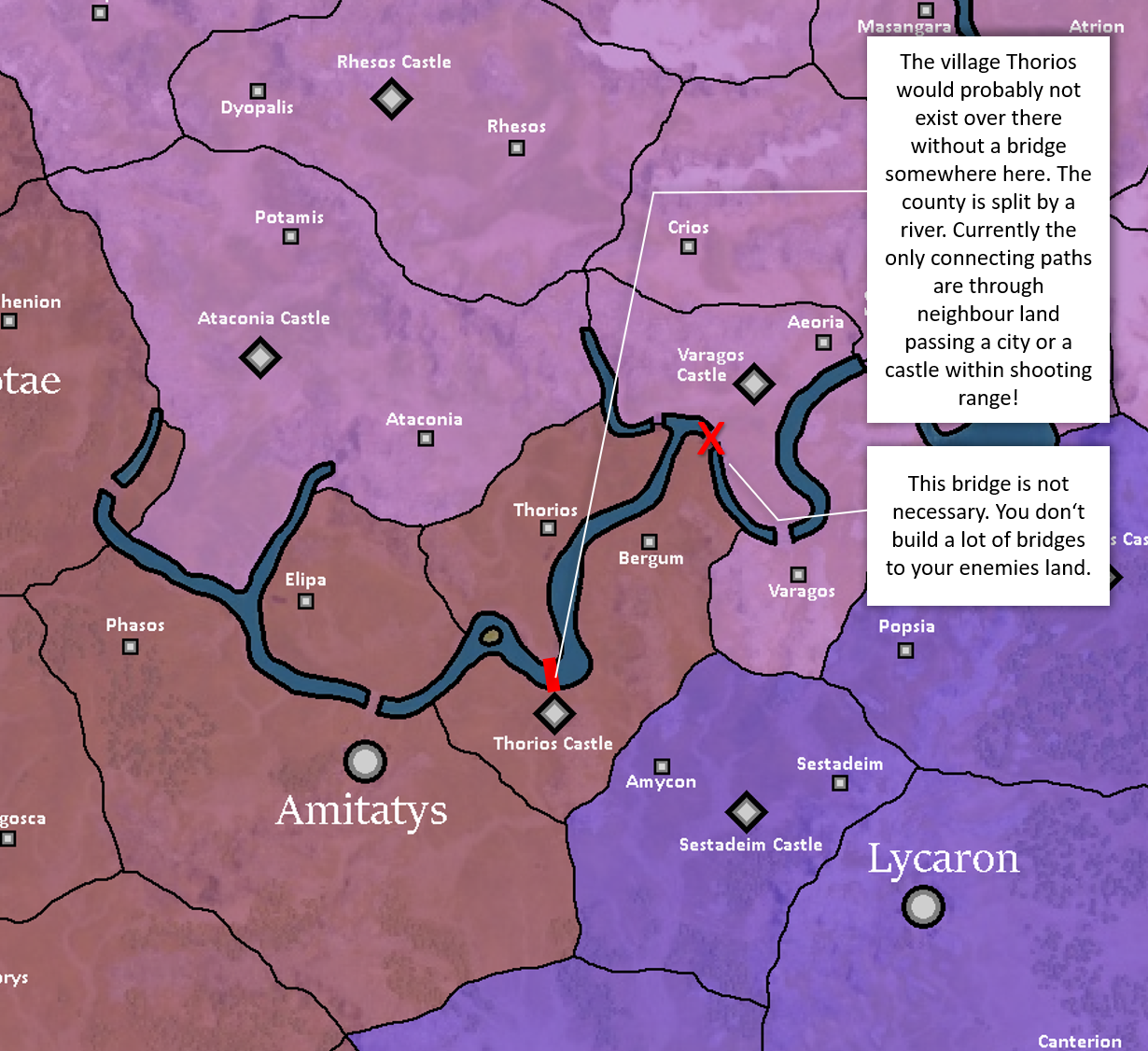
1. Thorios
a bridge might be missing here to hold this county together:
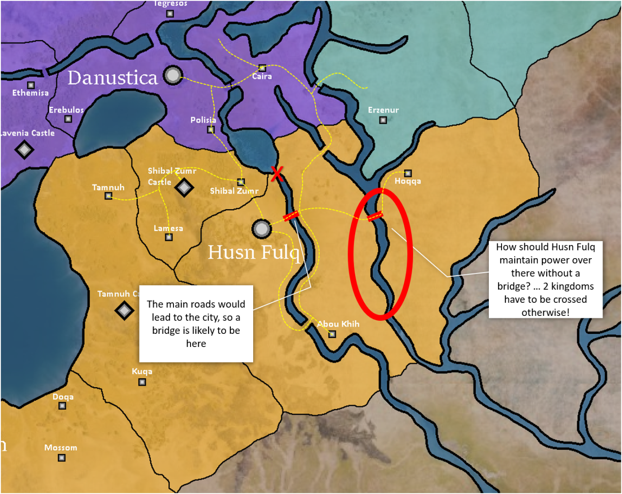
2. Husn Fulq
another bridge to maintain power in a cut-off region:
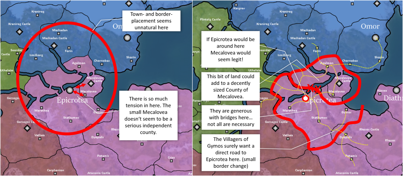
3. Epicrotea and Mecalovea
Macelovea is so small and so close to Epicrotea, it doesn't seem to be a serious independent county:
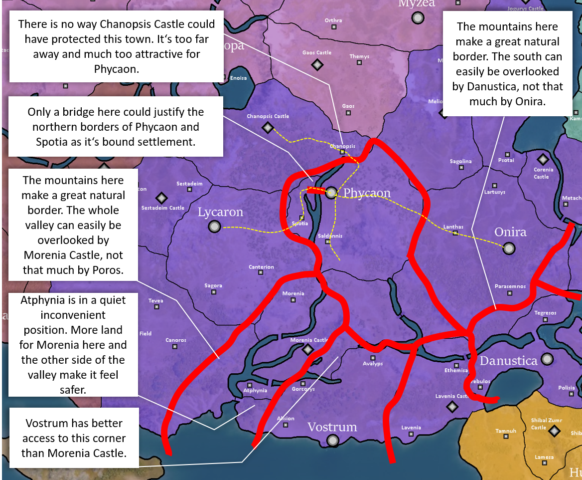
4. Phycaon + neighbors
Phycaon needs a connection to it's bound settlement Spotia, if there was no bridge, they would have claimed Chanopsis:
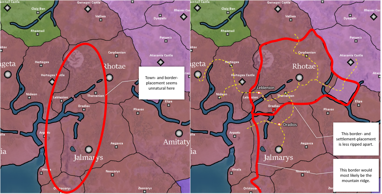
5. Rhotae
some changes considering road connections and natural borders:
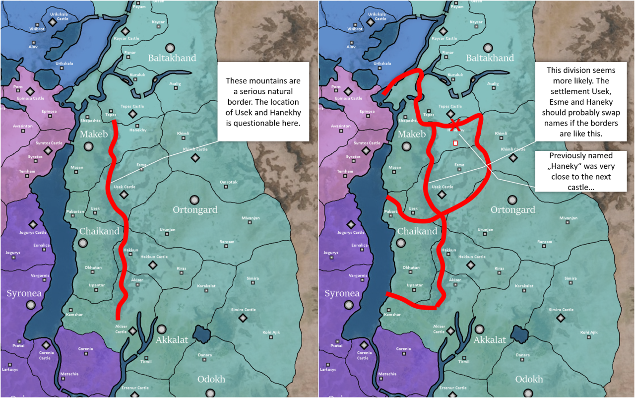
6. Khuzait Mountains
a huge natural border:
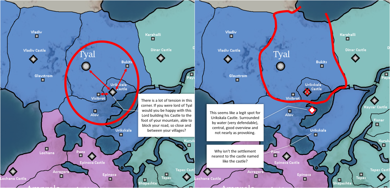
7. Tyal and Urikskala
a very provoking position:
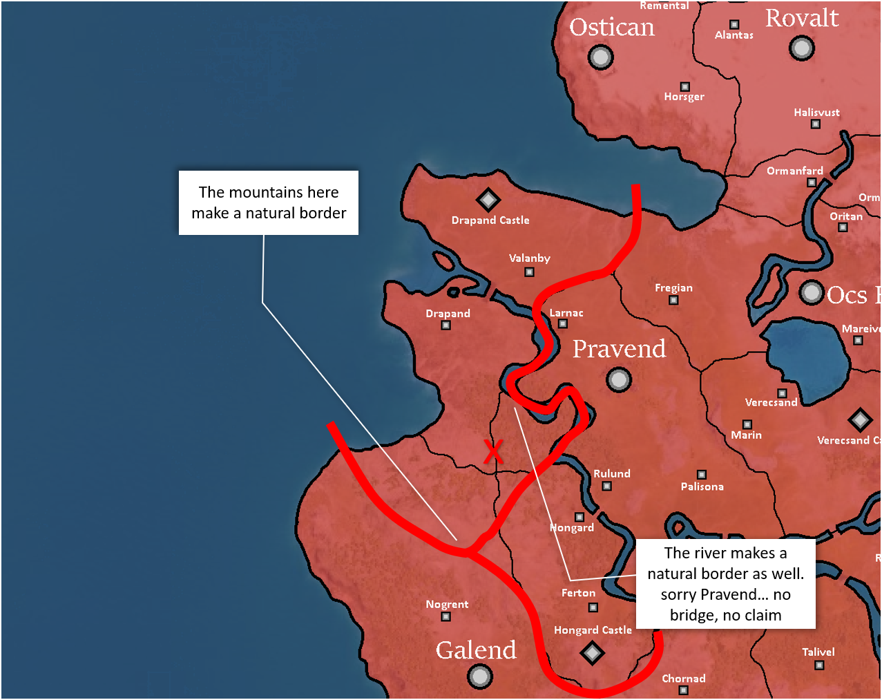
8. Drapand
a lot of natural borders:
(...if I had to choose a position for Drapand Castle, i would place it besides the bridge that holds my land together...)
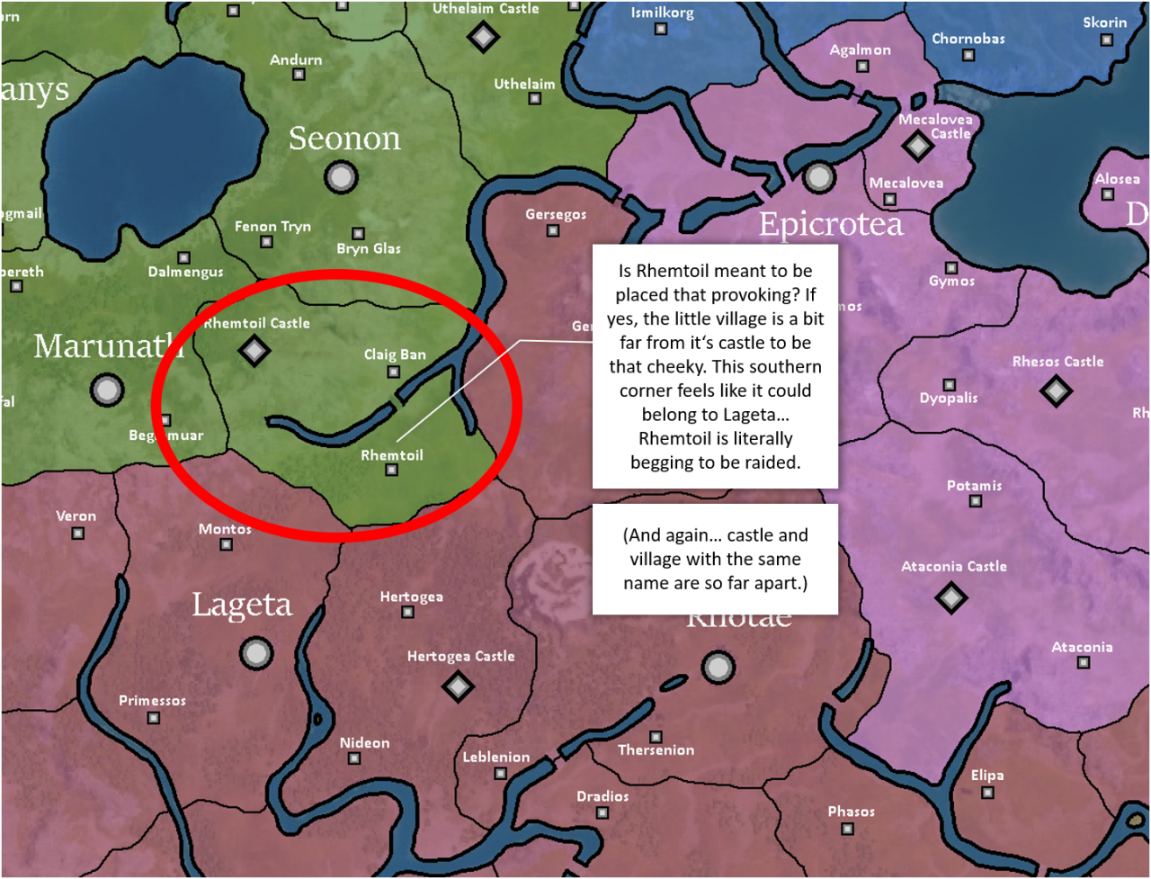
9. Rhemtoil
a risky position for a village:
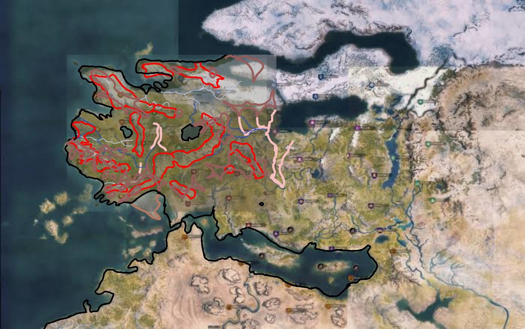
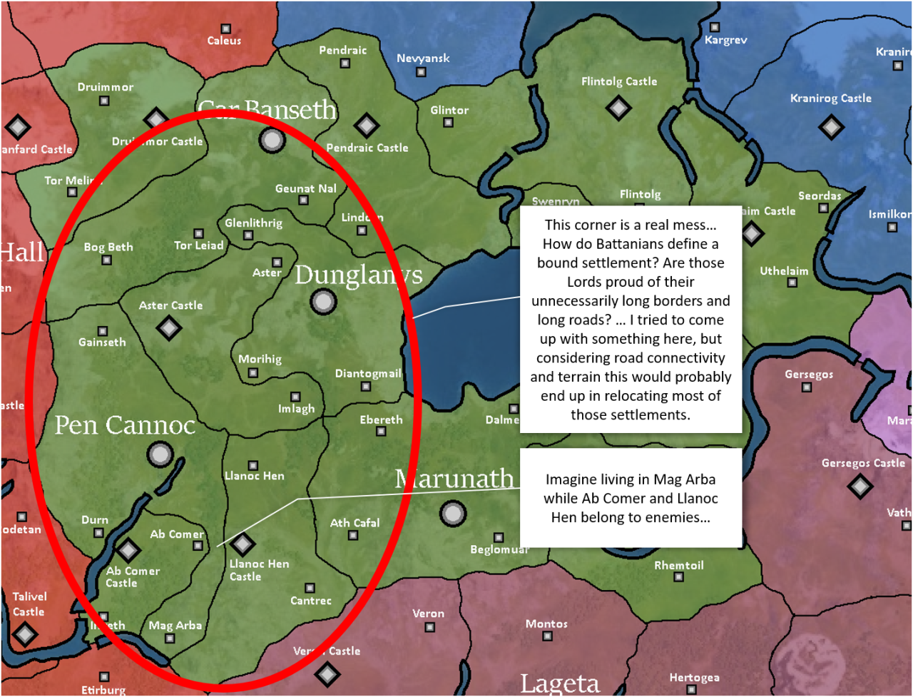
10. western Battania
the most chaotic locations and divisions on the map:
-> What do you think about it? Do you have similar examples?

Wandering through Calradia I came across some places where the placement of bound settlements, borders and bridges is questionable.
Some small changes like swapping 2 bound settlements or moving a bridge can make a huge difference for explaining how the counties would have developed and why settlements/castles/bridges are where they are.
Some thoughts about this:
- Bound settlements should have a direct connection to their castle/city within their own county. Currently some bound settlements are cut off their castle/city by a river or a mountain and the villagers have to cross the neighbours land to get to their castle/city.
- The bound settlements would have developed (1) were they have the resources but they would have stayed (2) where they are defendable and where they can be overlooked.
- Rivers and mountains are natural borders and were often used as a defensive feature, but currently a lot of counties in Calradia don't make use of their geography. Instead some counties are split apart. Some settlements are literally served their neighbours on a silver plate begging to be raided.
(maps thanks to Vesper_: https://forums.taleworlds.com/index.php?threads/?-map-of-calradia-1084-update-15-04-20.385748/)
1. Thorios
a bridge might be missing here to hold this county together:
2. Husn Fulq
another bridge to maintain power in a cut-off region:
3. Epicrotea and Mecalovea
Macelovea is so small and so close to Epicrotea, it doesn't seem to be a serious independent county:
4. Phycaon + neighbors
Phycaon needs a connection to it's bound settlement Spotia, if there was no bridge, they would have claimed Chanopsis:
5. Rhotae
some changes considering road connections and natural borders:
6. Khuzait Mountains
a huge natural border:
7. Tyal and Urikskala
a very provoking position:
8. Drapand
a lot of natural borders:
(...if I had to choose a position for Drapand Castle, i would place it besides the bridge that holds my land together...)
9. Rhemtoil
a risky position for a village:
10. western Battania
the most chaotic locations and divisions on the map:
-> What do you think about it? Do you have similar examples?
Last edited by a moderator: