Mack's Mapping Corner [ INCL: Waterloo map ] - More coming!

Users who are viewing this thread

Mack.

Grandmaster Knight
Scotts-Greys-at-Waterloo.jpg

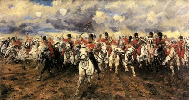
''La Haye Sainte, the one who wins the farmhouse. Wins the battle.'' - Napoleon Bonaparte


This is my little corner, and here you can view + download my maps. And look WIP ofcourse!


:!: Warning: All images are 1920x1080 :!:


Im currently working on this map; ( Conquest ) it will be based on this;
forest-of-niflhel.jpg


Waterloo map ( outdated tough )
9994D813A418BB111E19E9F7476F79A5A565D4EF


Fort Mackari
1A31767BED47D0F6B5CBC6CE8734538DA508DCDC


Special Thanks to:
Lassalle
KArantukki
Danyele
Skass
Chadman
Huge thanks to Olafson to help me out with the conquest-points!


Changelog ( For the ingame map )


Forest of Nifhil;
8/11/2012 said:
* Elevated ground
+ Added spawn ''hills''


Waterloo map;
12/10/12 said:
+Added La Haye Sainte
+Added Hougoumont & The fields
+Added ''British Hill''
+Added Papelotte
+Added Conquest Points

13/10/12 said:
+Added La Bella Alliance
+Added Mon Plaisir
+Added Conquest Point at Mon Plaisir to balance it.
+Added Spawn camps ( Tents, campaign table etc )
+Added Road from Hougoumont to Papelotte
+Added some more hills, trees, rocks & bushs

*Cannons are not in their positition anymore, you have to move them yourself
*Edit all roads, smooth them..
*Edit some hills ( made them higher )
*Edit ''The-Sand Pit'', made it some smaller


Map release, download links etc.


Map download links + scene codes


Fort Mackari


Other Downloads / info

The names of the conquest-points are not like waterloo! What to do?
- Download this: https://www.dropbox.com/s/377dtosbeyrtqm5/strings.txt
- Then put it at C:\Program Files (x86)\Steam\steamapps\common\mountblade warband\Modules\Napoleonic Wars    <-- Could be different at each PC! Just try to follow this path.
  - Enjoy!

When will the waterloo map be released?
I first want to host one-two conquest events on it :razz:

 
The Hill: ( You can see la haye sainte infront, and Hougomont on the far right )
E1F8F59819E757B6183656E2286D5A2B4534568B


Edit: And again you can't see so much depth.. To give you an idea the hill height is 30.. ( Got it from KArantukki, still thanks for it! )
 
I'll try make at as best as I can, I wanted to put all villages in it, even Plancenoit.. ( But I think the map is a bit to small for that ) But Papelotte is definitly going in. It will be on the far right.


Thanks Gokiller  :smile:
 
DiplexHeated said:
Dat hill,

http://www.thehindu.com/multimedia/dynamic/00853/04sm_waterloo_jpg_853571f.jpg

that reminds me of my brother who visited waterloo, you know what he said:

Hey Yuki i have been to waterloo!

me: oh cool you saw the three villages?

Bro: What 3 villages?

me: La Haye Sainte, Hougdemont(cant spell that) and papelotte?

Bro: havent seen them, I just saw a big hill with a lion on it.

me: facepalm*
 
WIP Checklist: ( They'll check it again when its finished )


General Checklist:
Detail checked by V0lum3D - Approved
Historic checked by Lassalle - Approved
Gameplay checked by ? - ?


Cannon Checklist:
Cannon range checked by Lassalle, Forteling & Mack - Approved
Cannon power checked by Lassalle, Forteling & Mack - Approved


Ground Checklist:
Ground Texture checked by V0lum3d & Lassalle - Approved
Ground elevation checked by Lassalle - Approved
''English hill'' checked by Lassalle - Approved
''French hill'' checked by Lassalle - Approved


Spawns:
Spawns checked by Lassalle & Mack - Approved
 
Thanks guys! With the help of Olafson, the map went alot quicker then I tought it would be, I think I'll finish for testing tonight. Then host an event on it, then release it for public  :mrgreen:.
 
Back
Top Bottom